The Kensico Dam

I’ve often driven past the Kensico Dam. It’s set back quite a bit from the road and from a distance it doesn’t look all that interesting. Still from time to time it occurred to me to get closer and take some pictures. But I kept putting it off. The other day I decided to go so an Uber, a short train ride, and a short walk and there I was.
The Official Website for Westchester County Government describes it as follows:
The Kensico Dam was built under the old dam that formed Lake Kensico, using stone taken from the adjacent Cranberry Lake Park. More electric power was applied for its creation than any other construction work for the Catskill water supply. The crushing plant at the quarry was the largest ever placed on contract work, and a railroad was built solely for the purpose of carrying debris from the construction site to landfills. At the quarry village, a school operated for the children, sewing classes for the women, and English language classes for the predominately Italian male workers.
The dam was completed in 1917. It is 307 feet high and 1,843 feet long, and forms the Kensico reservoir. It was acquired as parkland in 1963 from the New York City Watershed Commission and remains the property of the New York City Department of Environmental Protection. It is listed on the National Register of Historic Places as part of the Bronx River Parkway Reservation.
…
The park provides a unique setting for a wide variety of activities including cultural heritage celebrations and concerts, fitness classes and a fitness course, as well as areas for picnicking, in-line skating, walking and nature study.
During the holiday months of November and December, thanks to the Westchester Parks Foundation and its sponsors, the Kensico Dam Plaza is transformed into a winter wonderland full of sparkling lights and splendor. The annual Westchester’s Winter Wonderland Drive-thru Holiday Light Extravaganza.
Wikipedia provides significantly more information.
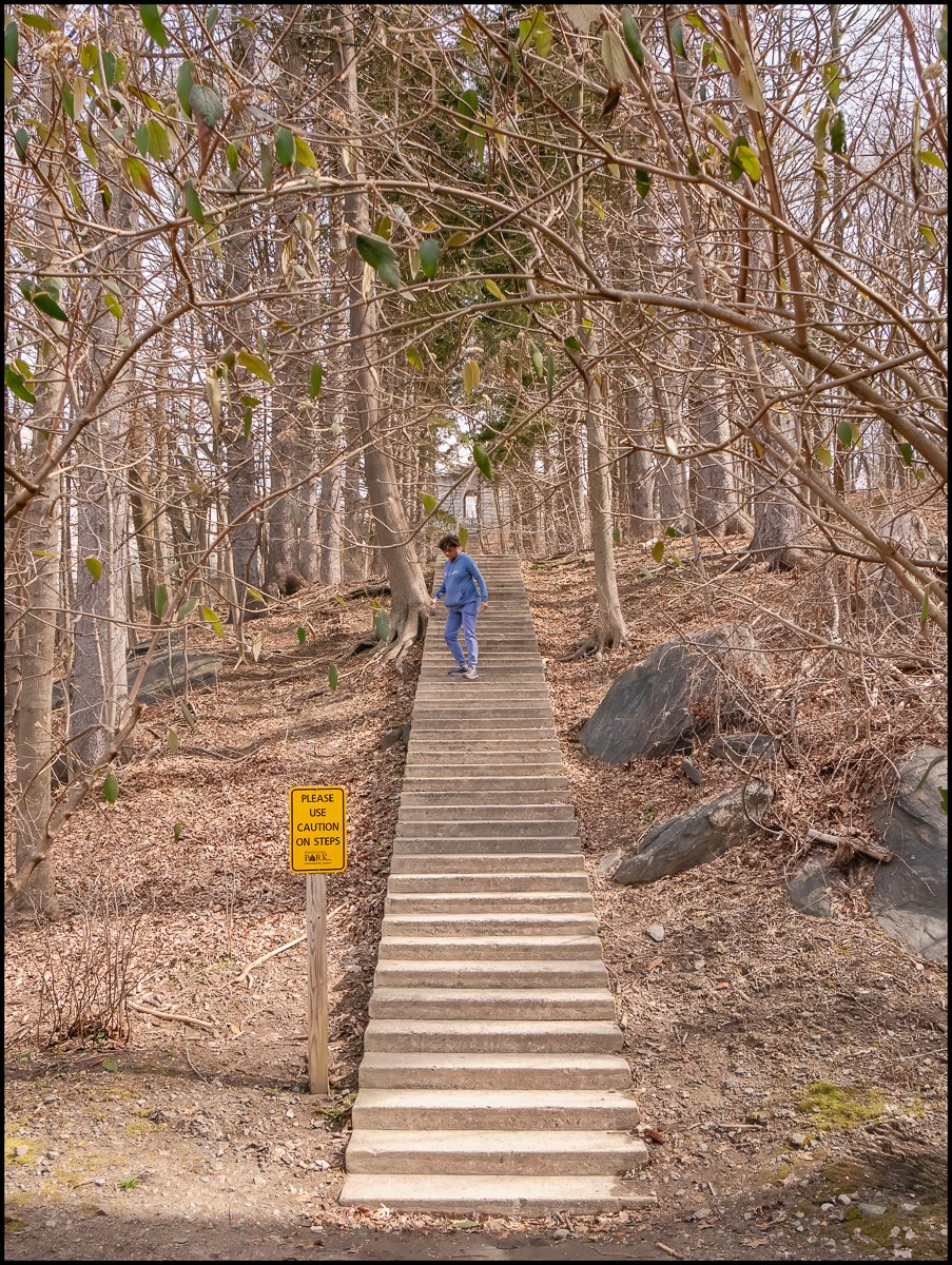
I decided to start my visit at the top of the dam. So how to get there? Well, there are steps at either end of dam so I walked up one side, then walked across the dam and then down the other side. I counted the number of steps: there were 205 of them (that’s one way)! My stamina and stability are not what they once were, so I was surprised that I made it up. Going down was much easier. But I managed it. I must be fitter than I thought. I used to be a lot heavier than I am now. In those days I don’t think I would have been able to do it. I would have been gasping for breath after a short time.
Note the yellow sign at the base of these steps. It reads: “Please use caution on the steps”.
I spoke to the woman in the picture. The picture gives the impression that she was struggling on the steps. That was far from being the case. She ran up the step to about where she is in the picture and then walked back down. She explained that she is a frequent visitor to the park and usually runs up the steps on one side, across the top, and then down the other side. The only reason she wasn’t doing that today was for lack of time. There was somewhere she had to be. She appeared to be extremely fit, and I saw her later running around the plaza at the base of the dam.

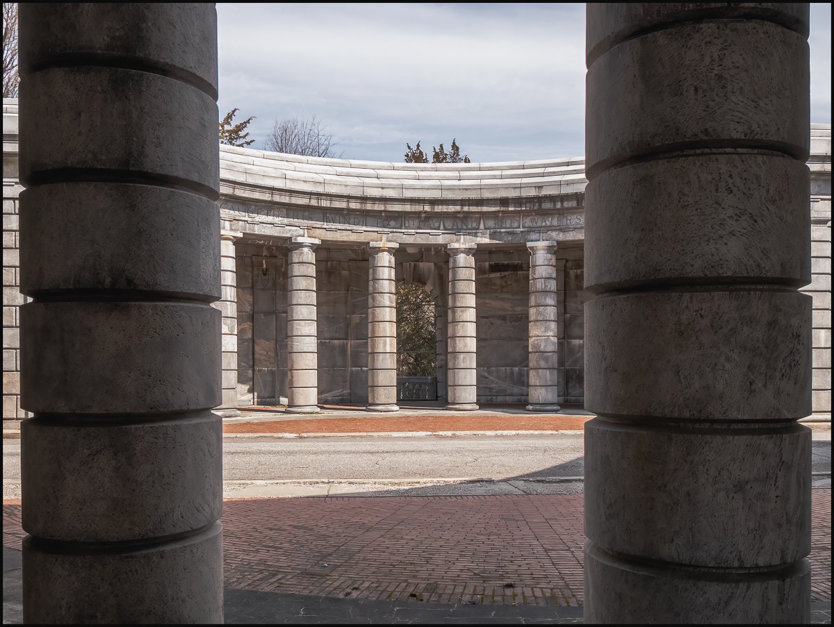
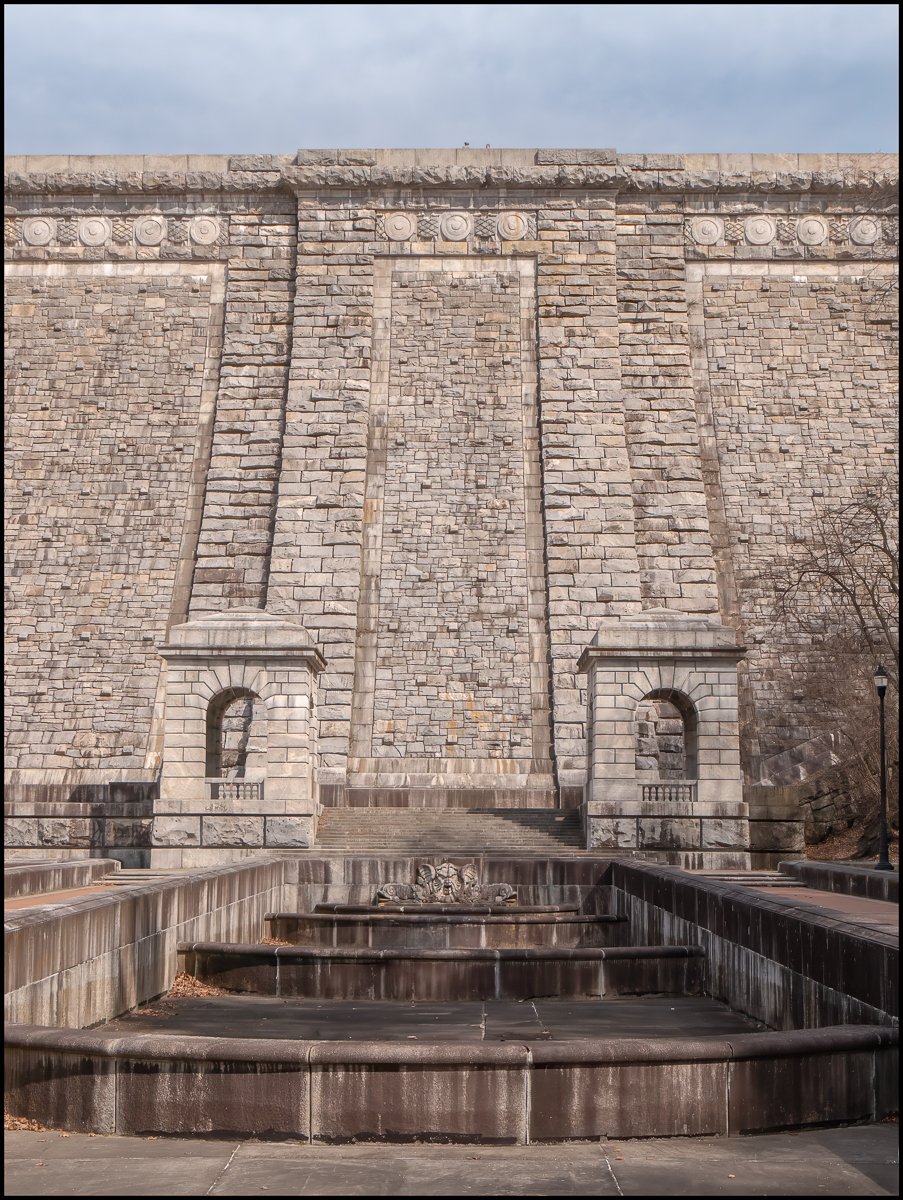
This was what greeted my when I got to the end of the steps. It seemed as if I had been transported to Ancient Greece. Pretty Impressive. The Architect was Frank Windsor.

Frank Edward Winsor (1870-1939) was the chief engineer for the Boston Metropolitan District Water Supply Commission, now the Massachusetts Water Resources Authority, from 1926 until his death in 1939 and was closely involved in the design and construction of Winsor Dam and Goodnough Dike which were built by the Commission to create the Quabbin Reservoir in Massachusetts. Winsor Dam was named for him. He was born November 16, 1870, in Providence, Rhode Island and died on January 30, 1939, a resident of West Newton, Massachusetts, where he had lived for many years at 189 Mt. Vernon Street. He received a Ph.B in 1892, an A.M. in 1896 an Sc.D. in 1929, all from Brown University. He later sat on Brown’s Board of Trustees. He was licensed as a Civil Engineer in 1892. On October 25, 1893, Frank E. Winsor married Catherine Holbrook Burton, who later taught at Brown. They had two daughters and a son. Their oldest child, Lucy, (April 16, 1897 – October 9, 1989), was a professor of economics at Wellesley College. She was married to Hugh B. Killough, (December 30, 1892 – December 13, 1976) who was a professor of economics at Brown. Together they wrote many books on business, economics and industry. His early work was on water and sewer projects for Boston. He was one of the engineers on the design and building of the Wachusett Dam. He also did work for the Charles River Basin Commission. From 1903-1915 he worked on projects for New York City including being in charge of the construction of the Kensico and Hillview reservoirs and 32 miles of Catskill Aqueduct. Frank E. Winsor was a Fellow of the American Academy of Arts and Sciences and a director and vice president of the American Society of Civil Engineers. From 1915-1926, he was chief engineer for the new water supply project for Providence, which involved the design and construction of the Scituate Reservoir and the earthen dam necessary to create it and the building of a water treatment plant. Like Quabbin Reservoir in Massachusetts, Scituate Reservoir is the largest body of water in its state. At the completion ceremonies for the project on September 30, 1926, Providence Mayor Joseph H. Gainer called Winsor “[T]he man to whom most of the credit for this undertaking belongs.” The dam is known today as the Gainer Memorial Dam in honor of the mayor. He left his successful work on the Scituate Reservoir for Providence to go on to greater work as chief engineer for the Metropolitan District Water Supply Commission in Massachusetts. His greatest accomplishment was the design and construction of Quabbin Reservoir and the Winsor Dam and Goodnough Dike which were built to dam the waters of the Swift River to create the reservoir. The dams were finished shortly after his death in 1939, but the Quabbin Reservoir did not fill to its maximum holding capacity until 1946. (Adapted from Wikipedia)
A pavilion is located at either end of the dam. It’s split into a north side and a south side, with the road passing through the middle. I guess he must have liked neo-classical architecture.

Interior view of the north side of the Kensico Dam West Pavilion. There’s lettering over the columns but I didn’t spot it at the time and so didn’t record what it said. From the pictures I think it’s from Psalm 146:18, which reads: “He sendeth out his word, and melteth them: he causeth his wind to blow, and the waters flow.” I think the lettering of on the north side of the west pavilion (seen in this photograph) has the second part (“He causeth his wind to blow, and the waters flow.” I’m guessing that the inscription on the south side probably contains the first part (“He sendeth out his word, and melteth them”). Once upon a time you could have looked through the arches towards the reservoir. You still can, but the view is somewhat obstructed by the mesh put there, presumably to stop people from jumping.
The North Castle Historical Society has an interesting video entitled: “The Lost Village of Kensico and the building of the Kensico Dam”
A site called Building the Kensico Dam and Reservoir has a fascinating series of Annual Reports covering the period 1906-1920. They’re full of interesting facts, old photographs, and diagrams showing the structure of the dam.

A great view over the Dam Plaza looking south towards the traffic circle where the Bronx River Parkway and the Taconic State Parkway join and White Plains.
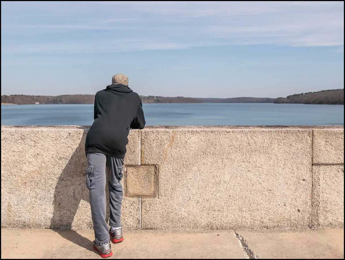
I wanted to take a picture of the reservoir but needed to something in the foreground to stop it from looking totally boring. I saw this guy leaning on the wall and asked him if I could take a picture with him in it. He was initially reluctant, but I explained that it would be taken from behind and nobody would know who the figure was. He agreed and I took the photograph. I showed it to him afterwards and he seemed content. I thanked him and moved on.
I liked the way it came out - exactly what I wanted.

Another view of the reservoir, this time from the East Pavilion looking north. According to Wikipedia:
The Kensico Reservoir is a reservoir spanning the towns of Armonk (North Castle) and Valhalla (Mount Pleasant), New York, located 3 miles (5 km) north of White Plains. It was formed by the original earth and gravel Kensico Dam constructed in 1885, which impounded waters from the Bronx and Byram rivers. In 1917, a new masonry dam was completed, replacing the old dam and expanding the water supply by bringing water from the Catskill Mountains over a distance of more than 100 miles. The reservoir mainly serves to store waters received from the Catskill Mountains west of the Hudson River. Along with the West Branch Reservoir and Boyds Corner Reservoir, it is one of four reservoirs within the Catskill/Delaware system outside the Catskill Mountains region. The other reservoir is the Hillview Reservoir.
It has a surface area of 2,140 acres, an average depth of 43.6 feet, and a maximum depth of 120 feet. It contains 30,000,000,000 gallons of water.
The Kensico Reservoir also hosts fishing and boating recreation. Every year, the reservoir is stocked with over 2,000 brown trout. In April 2016, the Kensico Reservoir was stocked with 8,620 brown trout 8.5 to 9.5 inches (22 to 24 cm) long.

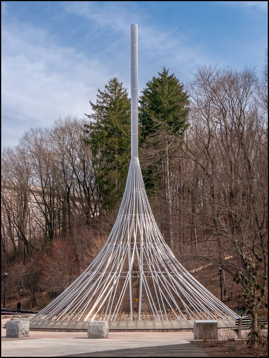
Another view from the top of the dam. More importantly, this was my first sighting of "The Rising", but more on that in a little while

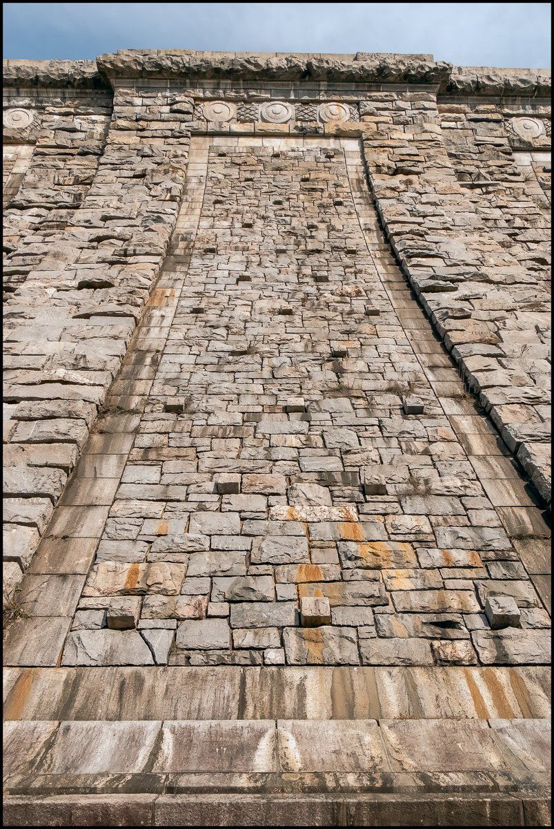
This attractive frieze runs the entire length of the dam. It looks nice, but I've no idea what it represents. Could it just be that it's just meant to be decorative?

The view above is from the west end of the dam looking east. The picture below shows the view from the east end of the dam looking west.
The figures at the base of the dam give a sense of scale. You get an idea of just how large this structure is.


The person being honored is Merritt Smith and the inscription reads: 1892-1926. Merritt H. Smith. Engineer for Forty years of the Water Supply of the City of New York. Colonel of Artillery in the Great War.
To get a sense of the number of people involved in this project see the extract below from The World’s Greatest Aqueduct. Water from the Catskill Mountains to the City of New York, by Alfred Doughlas Flinn, Harper’s Monthly, 1909 (reference to Merritt Smith in bold):
Goethe once wrote, “Dem Menschen ist ein Mensch noch immer lieber als ein Engel.” (To mankind men are always dearer than angels). And so perchance the reader may be possessed of sufficient human interest to inquire by what marshaling of men’s brains and brawn these great works are to be wrought. By appointment of Mayor George B. McClellan, under special legislation, John A. Bensel, a civil engineer, Charles N. Chadwick, a business man, and Charles A. Shaw, formerly president of the Hanover Fire Insurance Company, constitute the Board of Water Supply of the City of New York. They were chosen from lists of three names presented respectively by the Chamber of Commerce, the Manufacturers’ Association of New York, and the Board of Fire Underwriters. Mr. Bensel is president of the board, and succeeded Mr. J. Edward Simmons, who resigned in January, 1908, and is now president of the Chamber of Commerce.
Two bureaus comprise the board’s forces. In the Administration Bureau are the secretary, auditor, chief clerk, and purchasing agent, adjuster of claims, and chief of aqueduct patrolmen, each having a necessary corps of assistants, totaling for the bureau about 125 persons. Consulting Engineer John R. Freeman is the engineer adviser of the commissioners. At the head of the Engineering Bureau is Chief Engineer J. Waldo Smith. On his staff of consultants are Professor William H. Burr, Mr. Frederic P. Stearns, Allen Hazen, George W. Fuller, and a few other engineers and scientists of national and international reputation. Mr. Charles L. Harrison is Deputy Chief Engineer. Because of the geographical extent and the magnitude of the works, the Engineering Bureau has been organized in four departments: the Headquarters Department, with Alfred D. Flinn, Department Engineer, has charge of preparing designs and specifications for the dams, aqueducts, and other structures; executive and civil-service matters, inspection of manufactured materials for construction, and preparation of real estate maps and documents for all the departments, and in addition surveys and construction within the city limits. The Reservoir Department, with Carleton E. Davis at its head, is charged with all surveys and construction on the watersheds. Its chief work at present is the Ashokan reservoir, with its great dams and the headworks of the Catskill aqueduct. From the headworks to the divide of the Croton watershed sixty miles of Catskill aqueduct is under the care of the Northern Aqueduct Department, Robert Ridgway, Department Engineer, to whom falls the Hudson River crossing and the great siphons under the Rondout, Wallkill, and Moodna valleys. The remainder of Catskill aqueduct, with Kensico and Hill View reservoirs and the filters, falls to the Southern Aqueduct Department, with Merritt H. Smith as Department Engineer. The departments are divided into three or more divisions, which in turn are subdivided into several sections. Including engineers, inspectors, stenographers, clerks, laborers, and other assistants, the Engineering Bureau contains nearly 1000 persons.

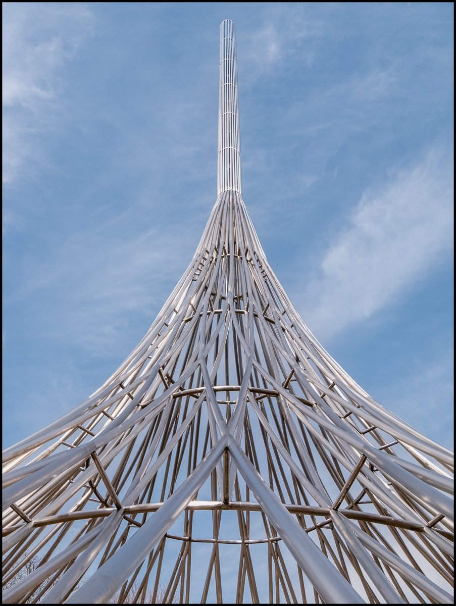
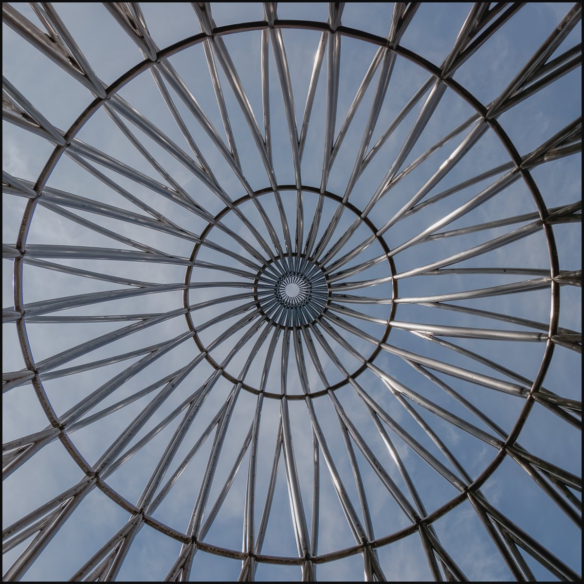
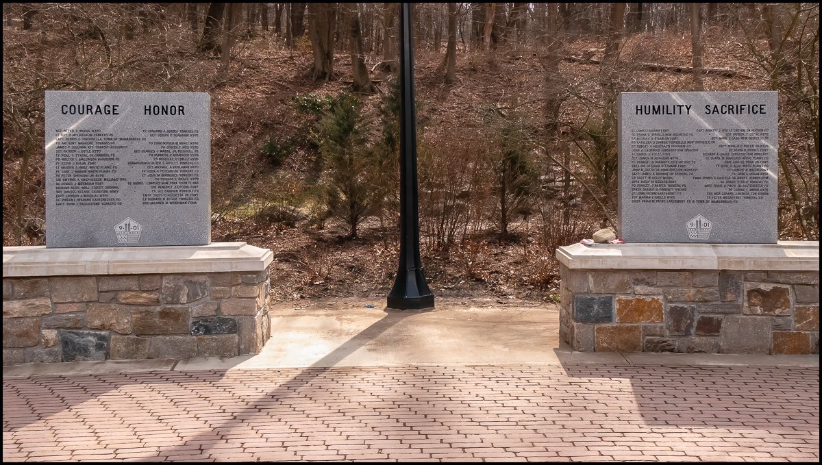
The Rising as seen from the West Pavilion.
According to The Official Website for Westchester County Government:
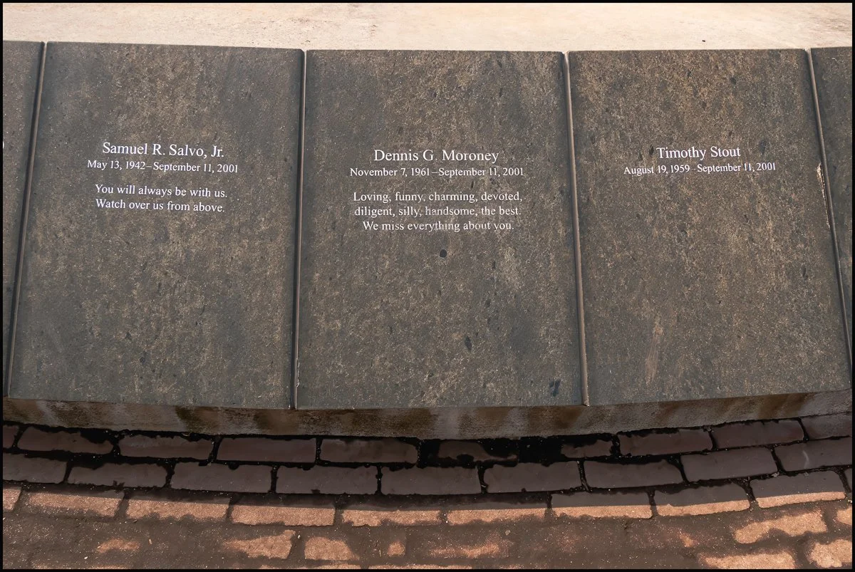
Westchester County’s September 11th Memorial incorporates the names of all the Westchester residents who died, the communities in which they lived and a quote about them from their loved ones. These words are engraved along the outside of the memorial’s circular base. Steel rods extend from the base like the spokes of a wheel before reaching skyward and intertwining. The memorial is surrounded by landscaping that includes perennial plantings and park benches.
The memorial is located at the intersection of many pathways and viewpoints,and thereby extends its presence into the surrounding landscape. The Rising is an open structure. It can be approached from all directions and allows people of all ages and abilities to view it, as well as move through it.
The Rising is the work of Frederic Schwartz, an internationally renowned Manhattan architect who, among many other accomplishments, designed the new Staten Island Ferry Terminal and who was also selected to create the September 11th Memorial for the State of New Jersey.
He founded the THINK team, whose design was selected as a finalist for the redesign of the World Trade Center. Schwartz, whose place of business was in view of the Twin Towers and who donated his time to the project, said that he wanted to design a memorial that expressed the immensity of such a loss while still conveying a sense of hope. His intention was to honor each person individually and unite them together as a community.
Schwartz won a citation award from the Westchester/Mid-Hudson chapter of the American Institute of Architects (AIA) for his design of The Rising.
The dedication reads:
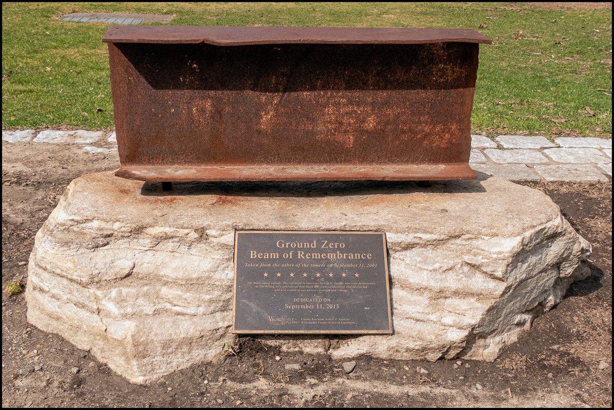
Ground Zero Beam of Remembrance
Taken from the ashes of the towers on September 11, 2001
* * * * * * * *
The beam whose custody was entrusted to Governor George E. Pataki, now rests permanently at The Rising, as a reminder of how much our country endured on that fateful day and as a symbol of our nation’s strength and courage
Dedicated on September 11, 2013
County Executive Robert P. Astoriano
Westchester County Board of Legislators
It's certainly a very impressive structure and I really enjoyed my visit.
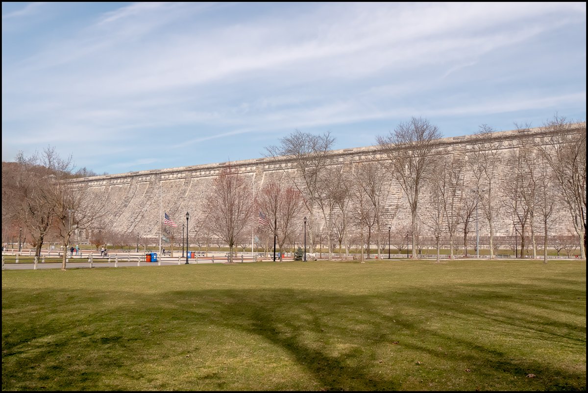
It's interesting to compare it with another nearby dam: The New Croton Dam

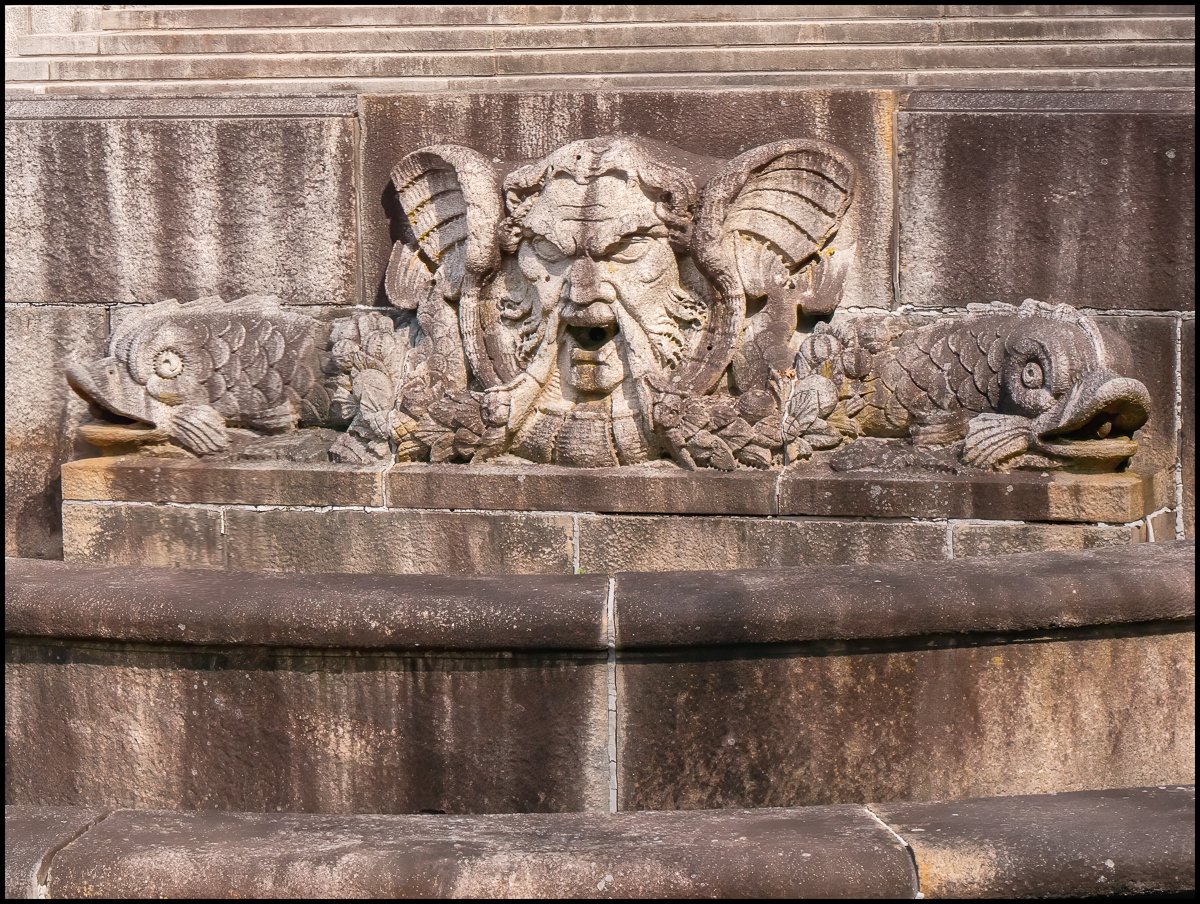
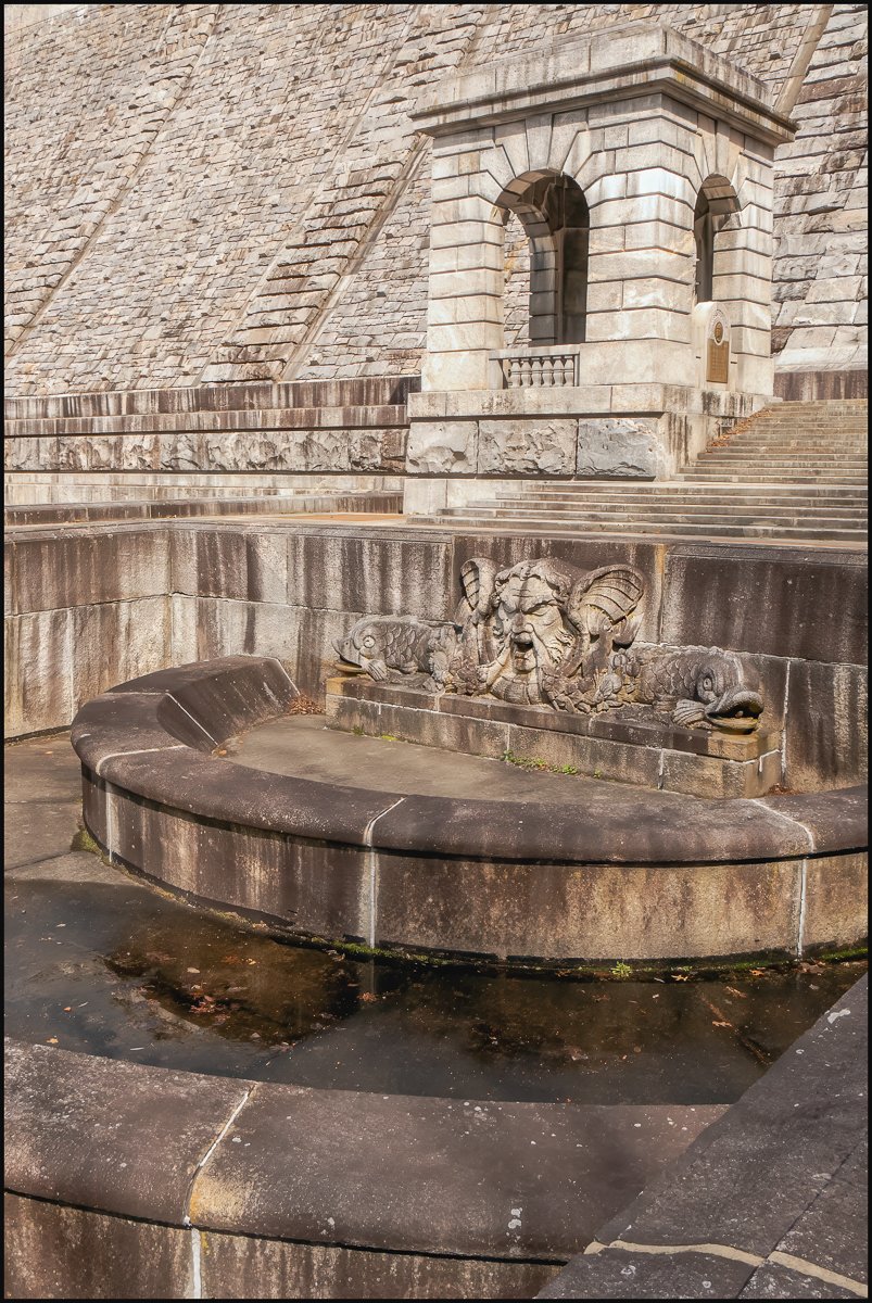
Although The New Croton Dam is only 10 feet shorter (297 feet vs 207 feet) it somehow feels much higher. Maybe this is because the Kensico Dam is 345 feet wider (2,188 ft vs 1,843 feet). My sense is that the Kensico Dam has more elaborate decoration. And The New Croton Dam has nothing to compare with the pavilions, fountains, cascades etc. of the Kensico Dam (just one fountain that does seem to work nowadays).
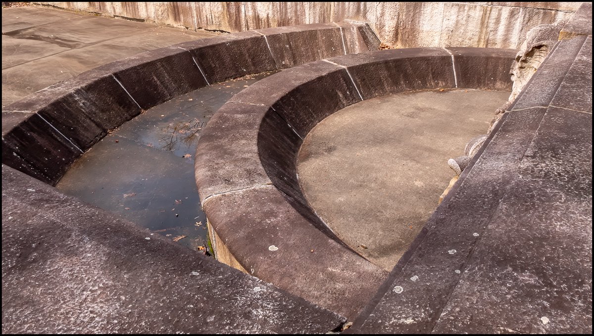
And the two dams have very different feels. The Kensico Dam exudes a feeling of a quiet, calm massiveness, where with The New Croton Dam you can't escape the sense of urgency and movement caused by the impressive spillway/waterfall on the left side. You can't escape the noise. Wherever you are: on top, at the base - it's always with you. The fountains/cascades etc. at the Kensico Dam were not running (I'm not sure that they ever do nowadays), when I was there but I suspect that if they were they would merely burble, where the spillway at The New Croton Dam roars!
Each dam has its own character and I love them both.