A Visit to New Hamburg

When this picture was taken this building was called “Lina’s Deli”. It’s now called “Cafe con Leche”.
“New Hamburg began as a port community on the river, with ships loaded and unloaded along nearby Point Street and then taken to Poughkeepsie and Wappingers Falls via road. By the 1840s, most of the Point Street lots had been taken and newer residents were turning to Main Street, a few blocks inland. The house at 9A Main Street, built by John Lawson, a descendant of the area's first European settlers, is the earliest known to have been built in the current district.
In 1848 construction began on the Hudson River Railroad. An 800-foot (240 m) tunnel[9] was built through a hillside north of town, and the work being done there triggered the development of Main Street as a commercial area. This continued after the tunnel was completed, since a passenger station and freight facilities were built for transshipment purposes. An 1858 map of the area shows four of the six houses already complete, and by 1876 another map shows all of them.
The railroad that had nurtured Main Street eventually caused its decline. In 1928, now part of the New York Central, the line was expanded from one track to two, and in the process Main Street's grade crossing was eliminated in favor of a new overpass called Bridge Street, one block to the north. Traffic to what little commercial activity remained at the riverfront simply followed the new street straight to it, turning Main into a short side street that remained important to the community only as the location of its general store.
After the Second World War, the railroad would itself decline, taking commercial activity along Main and in New Hamburg with it. The station was eventually closed, but later reopened as a commuter rail station by Metro-North Railroad, which eventually succeeded the New York Central (later the Penn Central and then Conrail) as the regional passenger operator on the line. Most of the buildings along Main were converted to primarily residential use.New Hamburg began as a port community on the river, with ships loaded and unloaded along nearby Point Street and then taken to Poughkeepsie and Wappingers Falls via road. By the 1840s, most of the Point Street lots had been taken and newer residents were turning to Main Street, a few blocks inland. The house at 9A Main Street, built by John Lawson, a descendant of the area's first European settlers, is the earliest known to have been built in the current district.
In 1848 construction began on the Hudson River Railroad. An 800-foot (240 m) tunnel[9] was built through a hillside north of town, and the work being done there triggered the development of Main Street as a commercial area. This continued after the tunnel was completed, since a passenger station and freight facilities were built for transshipment purposes. An 1858 map of the area shows four of the six houses already complete, and by 1876 another map shows all of them.
The railroad that had nurtured Main Street eventually caused its decline. In 1928, now part of the New York Central, the line was expanded from one track to two, and in the process Main Street's grade crossing was eliminated in favor of a new overpass called Bridge Street, one block to the north. Traffic to what little commercial activity remained at the riverfront simply followed the new street straight to it, turning Main into a short side street that remained important to the community only as the location of its general store.]
After the Second World War, the railroad would itself decline, taking commercial activity along Main and in New Hamburg with it. The station was eventually closed, but later reopened as a commuter rail station by Metro-North Railroad, which eventually succeeded the New York Central (later the Penn Central and then Conrail) as the regional passenger operator on the line. Most of the buildings along Main were converted to primarily residential use.” (Wikipedia).
“The New Hamburg web site has this to say about the hamlet:
“The hamlet of New Hamburg is one of the few communities on the Hudson River located primarily between the railroad tracks and the river. It began at the turn of the 19th century as a port and producer of lime.
These two industries developed along the river at the northern and southern ends of the hamlet. The deep channel and wharf facilities created both freight and passenger services; sloops, schooners and steamers would soon stop in New Hamburg. By 1820, a grid plan was developed by the major landholders, JD (Drake) and SB (Bogardus). This was the first demonstration of a planned residential community which would later be expanded by Asa Conklin to include the eastern portion of this peninsula. By the mid-19th century, with the completion of the railroad, the commercial center of the hamlet shifted from the waterfront to Main Street. The 1876 map show three hotels, five stores, two blacksmith shops, a print shop and a lumber & coal yard. This was the economic highpoint for the community. For the next hundred years, the railroad would leave its mark on the physical and social development of New Hamburg. Streets and structures would come and go to accommodate the railroad’s expansion and reduction. Many Italian immigrants who were part of the early railroad construction chose to make New Hamburg home. The 20th century brought a close to the development in the hamlet. With the rise of the automobile, replacing river and train traffic, new Hamburg was fortunately left to rest. Today New Hamburg offers an excellent collection of modest 19th century village architectural styles, as well as a clear timeline of the development of transportation in this country. The river still plays a major role, but has not become a recreational feature, as opposed to the commercial and industrial factor it was in the 19th century. With the emphasis on residential and recreational use and its protected geographic location away from major thoroughfares, New Hamburg remains an intact, living waterfront hamlet.”

St. Nicholas-on-the-Hudson church in New Hamburg, NY. Formerly called Zion Memorial Chapel it is an historic Carpenter Gothic style Episcopal church in a picturesque location overlooking the Hudson River. It has been listed on the National Register of Historic Places since 1987. To me the church seemed to have a somewhat “maritime” look to it. The kind of place you might come across in Moby Dick. Also something Scandinavian. I could see this overlooking a fjord in Norway.

The inside of the church remains unchanged since it’s construction in 1902. Wooden pews surround a center aisle and the inside is finished in plaster. The flags added a nice splash of color.

There are three narrow gothic windows on either side of the church. They are filled with translucent leaded glass surrounded by stained glass. A shaft of light was shining through one of the windows and illuminating these vessels. I was particularly taken by how it reflected from the jug and shone through the bottle.


More pictures of the church above.

I came across a small park with this colorful, if somewhat weather-beaten, train. I loved the colors and the textures.

John A. Lawson House c.1845. The New Hamburg walking tour describes it as follows:
“This Greek Revival wood frame structure is the earliest structure on the block. An 1860 transformation is demonstrated with the addition of a crossgable and bracketing.”
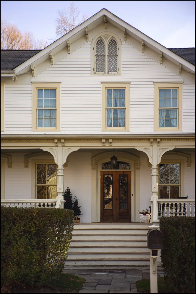


Some houses in Main Street Historic District above. The Main Street Historic District in New Hamburg, New York, United States is located along that street just west of the train station. Six buildings on a single acre (4,000 m²) are an intact remnant of the hamlet as it was developed in the middle of the 19th century, prior to the Hudson River Railroad's construction, which cut it in half.
Its contributing buildings, three houses and three commercial buildings, are made of brick and representative of vernacular applications of the then-popular Greek Revival and Gothic Revival styles. The neighborhood was recognized as a historic district and added to the National Register of Historic Places in 1987. It is the smallest in area of the 62 Main Street Historic Districts on the Register.
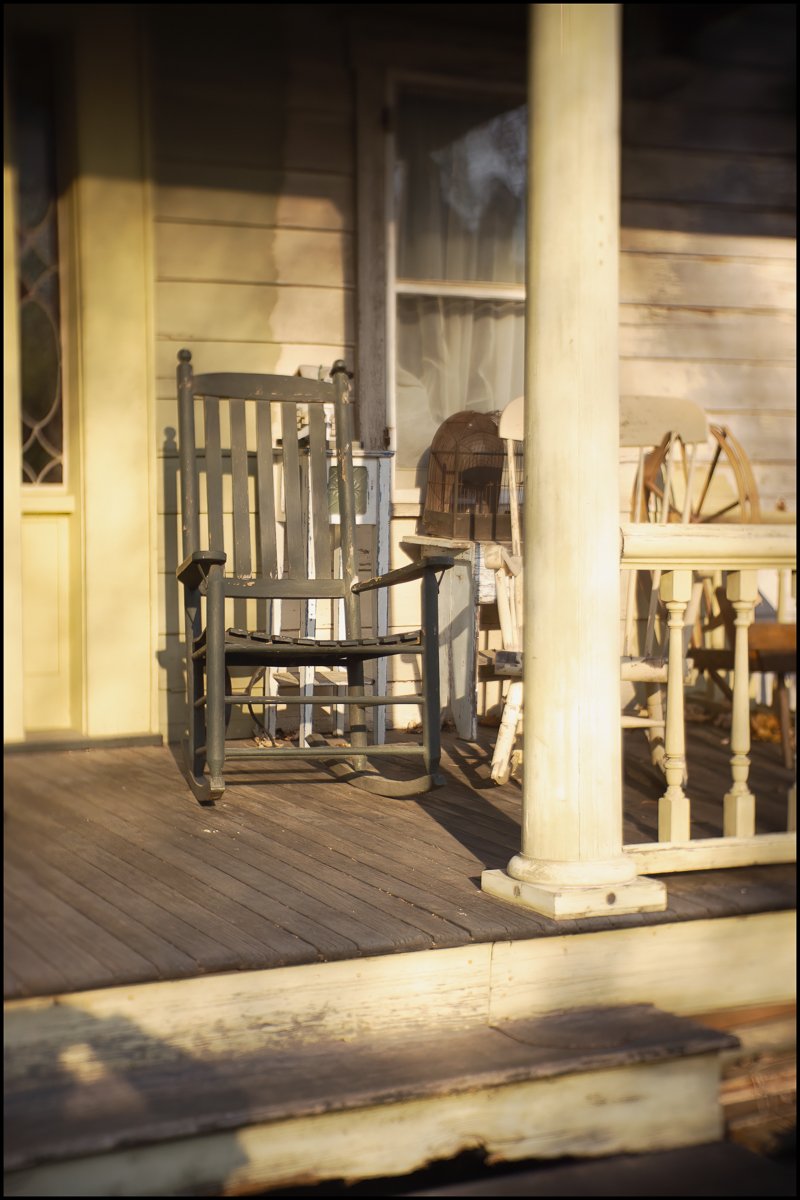
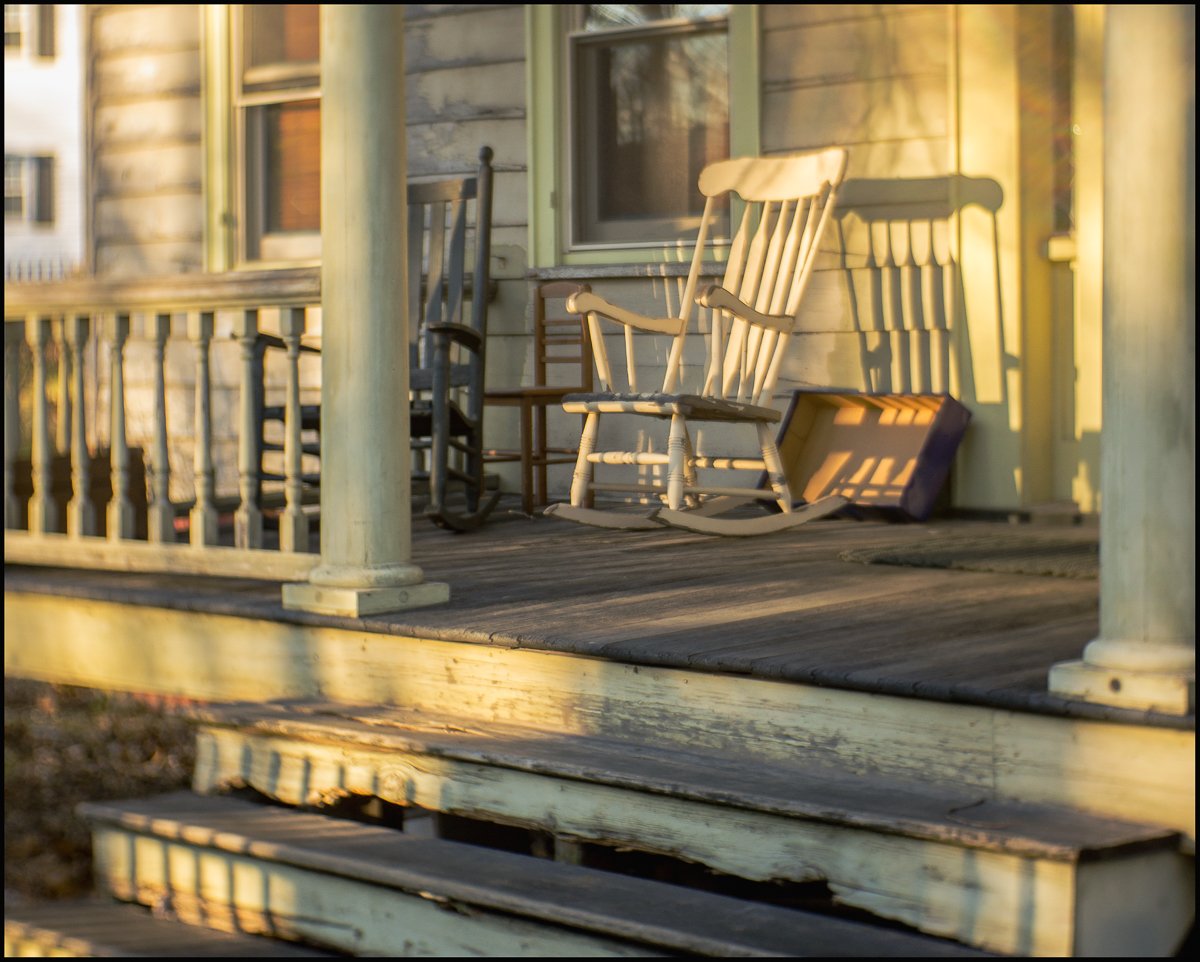
Who could ignore a rocking chair on the porch? It’s hard to believe that this is really not that far from New York City.

As I was walking around I saw a school bus turning into the street. The yellow ‘children at play’ sign had already caught my attention. The yellow in the school bus seemed to fit in well so I waited for it to turn a little so I got the side on view showing more of the yellow.
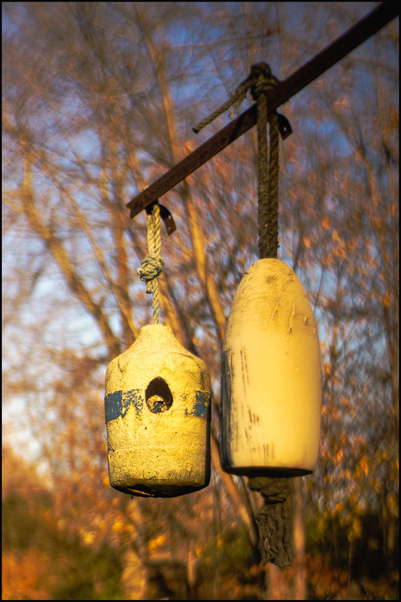
I’m not entirely sure what these are. Maybe some kind of ceramic bird box


This bridge goes over the railroad tracks. It carries the pipe above.

Stop Sign

Roses
You may have noticed that the photos have a somewhat strange look to them: often soft with the focus point unpredictable and all over the place. This is because they were taken with a RainbowImaging 35MM F1.7 TV Lens + Lens Adapter for Sony NEX (cost about $28). If you like really sharp lenses then this isn’t for you. However, it has an interesting ‘creamy’ kind of feel, which I quite like. I particularly like the way it works in the train picture.
The image of the rose shows the peculiar characteristics of this lens. It’s wierd, but I like i.